Collection
Share:

Visualizing where rich and poor people really cross paths—or don’t

Ben Paynter at Fast Company: “…It’s an idea that’s hard to visualize unless you can see it on a map. So MIT Media Lab collaborated with the location intelligence firm Cuebiqto build one. The result is called the Atlas of Inequality and harvests the anonymized location data from 150,000 people who opted in to Cuebiq’s Data For Good Initiative to track their movement for scientific research purposes. After isolating the general area (based on downtime) where each subject lived, MIT Media Lab could estimate what income bracket they occupied. The group then used data from a six-month period between late 2016 and early 2017 to figure out where these people traveled, and how their paths overlapped.

[Screenshot: Atlas of Inequality]

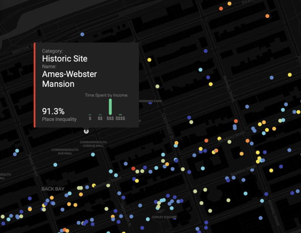
The result is an interactive view of just how filtered, sheltered, or sequestered many people’s lives really are. That’s an important thing to be reminded of at a time when the U.S. feels increasingly ideologically and economically divided. “Economic inequality isn’t just limited to neighborhoods, it’s part of the places you visit every day,” the researchers say in a mission statement about the Atlas….(More)”.

Share
How to contribute:

Did you come across – or create – a compelling project/report/book/app at the leading edge of innovation in governance?

Share it with us at info@thelivinglib.org so that we can add it to the Collection!

About the author

Get the latest news right in you inbox

Subscribe to curated findings and actionable knowledge from The Living Library, delivered to your inbox every Friday

Related articles